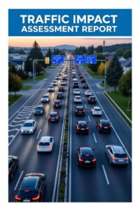
What Is Traffic Impact Assessment (TIA)
What Is A Traffic Impact Assessment?
A Traffic Impact Assessment (TIA) is a specialized study that evaluates how a proposed development—whether it’s a new housing complex, shopping center, office building, or industrial facility—will affect the surrounding transportation system.
At its core, a Traffic Impact Assessment is about foresight: it predicts how a project will change the way people and goods move in an area.
It’s not just about counting cars—it’s a dynamic process that balances the needs of a new development with the existing infrastructure’s capacity, safety, and livability.
A Traffic Impact Assessment goes beyond simple traffic counts by integrating local context, stakeholder priorities, and long-term planning goals. For example, it considers not only vehicle traffic flow solutions but also pedestrians, cyclists, and public transit users, ensuring a holistic view of mobility.
The process starts with defining the study area—typically the roads, intersections, and transit nodes near the project site.
Data is collected on current conditions: traffic volumes, crash histories, signal timings, and even pedestrian patterns. This isn’t just a snapshot; it’s a baseline to project future scenarios, factoring in the additional trips the development will generate.
Unlike blog posts that might gloss over the technical side, a TIA relies on rigorous methods like trip generation models (based on standards like the Institute of Transportation Engineers’ manuals), traffic simulation software, and sometimes machine learning to predict flow changes.
What sets a Traffic Impact Assessment (TIA) apart from a casual write-up is its role as a negotiation tool. Developers, city planners, and transportation agencies use it to identify pressure points—say, an intersection that’ll become gridlocked or a crosswalk that’ll get overwhelmed—and propose solutions.
These could be physical (widening roads, adding turn lanes, or building bike paths) or operational (adjusting signal timings, enhancing transit stops).
The Traffic Impact Assessment also considers equity: will the project disproportionately burden certain communities? It’s a living document, often revised as projects evolve or public input reshapes priorities.
Unlike blog content that might frame TIAs as bureaucratic hurdles, they’re better seen as a bridge between ambition and reality. They ensure a new development doesn’t choke the transportation network or compromise safety. For instance, a TIA might reveal that a proposed warehouse will spike truck traffic on a residential street, prompting rerouting or infrastructure upgrades before construction begins. It’s proactive, not reactive..
Technical Method Used For Traffic Impact Assessment Report?
A Traffic Impact Assessment (TIA) employs a range of technical methods to evaluate and predict the effects of a proposed development on the surrounding transportation network.

These methods are grounded in data collection, analysis, and modeling to ensure accurate forecasts and effective mitigation strategies. Below, I outline the key technical approaches used in TIAs.
1. Data Collection and Baseline Analysis
- Traffic Counts: TIAs begin with collecting current traffic data, including vehicle volumes, turning movements, and peak-hour patterns at key intersections and road segments. This is typically done using automated counters (e.g., pneumatic tubes, video detection) or manual observations over multiple days to capture variations (e.g., weekday vs. weekend).
- Multimodal Data: Beyond vehicles, TIAs assess pedestrian flows, cyclist activity, and public transit ridership. For example, pedestrian counts at crosswalks or bus stop boarding/alighting data help evaluate non-motorized impacts.
- Crash Data Analysis: Historical accident records (e.g., from police or transportation agencies) are analyzed to identify safety issues, such as high-crash intersections, that the development might exacerbate.
- Road and Infrastructure Inventory: The physical characteristics of the study area—lane widths, signal timings, crosswalk locations, bike lane availability—are documented to establish baseline conditions.
2. Trip Generation Estimation
- Trip Generation Models: The TIA estimates the number of new trips the development will generate using standardized references like the Institute of Transportation Engineers (ITE) Trip Generation Manual. These models provide trip rates based on land use (e.g., residential, retail, office) and variables like square footage or number of dwelling units. For example, a 100-unit apartment complex might generate 6.5 trips per unit during peak hours.
- Trip Types: Trips are categorized into primary (new to the area), pass-by (vehicles already on the road stopping at the site), and diverted (trips rerouted from nearby roads). This helps avoid overestimating impacts.
- Adjustments for Local Context: Standard rates are adjusted based on local factors, such as proximity to transit or mixed-use environments, which may reduce vehicle trips.
3. Trip Distribution and Assignment
- Trip Distribution: This determines where the generated trips will go, based on existing traffic patterns, population centers, and regional attractors (e.g., employment hubs). Gravity models or local travel surveys are used to assign percentages of trips to specific routes or destinations.
- Traffic Assignment: Trips are assigned to specific roads and intersections using network models. Software like VISSIM or Synchro simulates how new trips integrate with existing flows, accounting for route choices and congestion effects.
4. Traffic Modeling and Simulation
- Capacity Analysis: The TIA assesses the capacity of roads and intersections using tools like the Highway Capacity Manual (HCM). Key metrics include Level of Service (LOS), which rates traffic flow from A (free-flowing) to F (gridlocked), and delay times at intersections.
- Microsimulation: For complex scenarios, microsimulation software (e.g., VISSIM, Aimsun) models individual vehicle movements, capturing dynamic interactions like queue formation or signal delays. This is especially useful for urban areas with heavy pedestrian or transit activity.
- Future Conditions Forecasting: Models project future traffic conditions, typically 5–20 years out, incorporating background growth (unrelated to the development) and planned infrastructure changes. This uses regional growth rates or transportation plans.
5. Impact Analysis
- Intersection and Roadway Performance: The TIA compares existing and future conditions (with and without the development) to identify impacts, such as increased delays or LOS degradation. For example, an intersection might drop from LOS B to D, signaling the need for mitigation.
- Safety Impacts: Potential safety issues are evaluated using crash modification factors (CMFs) from databases like the Crash Modification Factors Clearinghouse. For instance, adding a left-turn lane might reduce rear-end collisions by a predictable percentage.
- Multimodal Impacts: Effects on pedestrians, cyclists, and transit are quantified, such as increased crossing times or bus stop overcrowding.
6. Mitigation Analysis
- Mitigation Measures: If impacts exceed acceptable thresholds (e.g., LOS below a municipality’s standard), mitigation is proposed. This could include physical changes (adding lanes, roundabouts, or crosswalks) or operational adjustments (optimizing signal timings, enhancing transit service).
- Iterative Modeling: Proposed mitigations are tested in the traffic model to confirm effectiveness. For example, Synchro might show that extending a green light by 10 seconds reduces delays to acceptable levels.
7. Advanced Techniques
- Big Data and Machine Learning: Some TIAs leverage real-time data from GPS, mobile apps, or connected vehicles to refine trip generation and distribution. Machine learning can predict behavior in unique contexts, like mixed-use developments.
- Geographic Information Systems (GIS): GIS tools map traffic patterns, land use, and infrastructure, providing spatial insights into impacts and mitigation feasibility.
- Sensitivity Analysis: This tests how changes in assumptions (e.g., higher-than-expected trip generation) affect outcomes, ensuring robust findings.
Role Of Traffic Impact Assessment At Urban Areas
A Traffic Impact Assessment (TIA) plays a critical role in urban areas by ensuring that new developments or infrastructure changes align with the complex, interconnected demands of city transportation systems.
Unlike rural or suburban contexts, urban environments feature dense populations, diverse travel modes (vehicles, pedestrians, cyclists, transit), and constrained infrastructure, making TIAs essential for managing growth while preserving mobility, safety, and livability.
Below, I outline the unique roles of TIAs in urban settings, avoiding generic explanations and focusing on their practical, context-specific contributions.
1. Facilitating Sustainable Urban Growth
- Balancing Development and Capacity: Urban areas often have limited space for road expansion, so TIAs assess whether existing infrastructure can handle additional traffic from developments like high-rise apartments or commercial centers. They quantify impacts on congested corridors and propose solutions like demand management (e.g., carpool incentives) rather than just adding lanes.
- Promoting Mixed-Use Development: TIAs evaluate how mixed-use projects, common in cities, reduce vehicle trips by encouraging walking or transit use. For example, a TIA might show that a development with retail and residential components generates fewer external trips than separate projects, supporting compact urban design.
2. Enhancing Multimodal Transportation
- Prioritizing Non-Motorized Modes: Urban TIAs emphasize pedestrians and cyclists, assessing impacts on sidewalks, crosswalks, and bike lanes. For instance, a new office tower might increase pedestrian volumes, requiring wider crossings or signal adjustments to maintain safety.
- Supporting Public Transit: TIAs analyze effects on bus or rail systems, such as increased ridership or conflicts between vehicles and transit stops. They might recommend dedicated bus lanes or station upgrades to accommodate a development’s transit demand, ensuring cities remain transit-friendly.
3. Mitigating Congestion and Bottlenecks
- Intersection-Level Analysis: Urban areas rely on tightly spaced intersections, so TIAs use tools like Synchro or VISSIM to model delays and queue lengths. For example, a TIA might identify that a new mall will overload a key junction, proposing signal optimization or a roundabout to restore flow.
- Network-Wide Impacts: Unlike rural TIAs, urban assessments consider ripple effects across the grid, using regional models to prevent congestion from spilling into adjacent neighborhoods. This ensures localized fixes don’t create problems elsewhere.
4. Improving Safety in Complex Environments
- Addressing Urban Crash Risks: Dense urban areas have higher risks of vehicle-pedestrian or vehicle-cyclist conflicts. TIAs analyze crash data and use crash modification factors (CMFs) to recommend safety measures, like protected bike lanes or pedestrian countdown signals, tailored to urban patterns.
- Managing Delivery and Service Traffic: Urban developments like restaurants or warehouses generate delivery traffic. TIAs assess loading zone needs or alley impacts to prevent double-parking or unsafe maneuvers in tight spaces.
5. Supporting Equity and Community Goals
- Minimizing Disparate Impacts: TIAs in urban areas evaluate whether a project disproportionately affects underserved communities, such as by increasing traffic through low-income neighborhoods. They propose mitigations like traffic calming or enhanced transit access to ensure equitable outcomes.
- Community Engagement: Urban TIAs often incorporate public input to reflect local priorities, such as preserving walkable streets or reducing noise pollution. This makes them a bridge between technical analysis and community vision, unlike the more standardized process in less dense areas.
6. Guiding Policy and Long-Term Planning
- Informing Zoning and Land Use Decisions: Urban TIAs provide data to support or reject zoning changes, ensuring development aligns with city plans like transit-oriented development (TOD). For example, a TIA might justify higher density near a subway station by showing minimal traffic impacts.
- Integrating with Urban Mobility Plans: Cities often have comprehensive mobility strategies (e.g., Vision Zero for safety or net-zero emissions goals). TIAs align recommendations with these plans, such as prioritizing bike infrastructure or electric vehicle charging to meet sustainability targets.
7. Adapting to Urban Complexity with Advanced Tools
- Leveraging Technology: Urban TIAs use sophisticated methods like microsimulation (e.g., Aimsun) to model complex interactions between vehicles, pedestrians, and transit in dense networks. They may also incorporate real-time data from GPS or mobile apps to capture dynamic urban travel patterns.
- Scenario Testing: Given urban unpredictability, TIAs test multiple scenarios (e.g., peak events, future growth) to ensure resilience. For instance, a TIA for a stadium might model game-day traffic alongside regular commuter flows.
Summary On Traffic Impact Assessment PDF Report.

A Traffic Impact Assessment is a vital tool in urban and transportation planning. It ensures that new developments are integrated smoothly into the existing transportation network and that proactive measures are taken to maintain road efficiency and safety.
Here’s A Typical Component Of Traffic Impact Assessment?
- Project Description: Details of the proposed development, land use, and size.
- Existing Conditions Analysis: Review of current traffic volumes, road capacities, and accident history.
- Trip Generation and Distribution: Estimation of how many new trips the development will generate and where they will go.
- Traffic Assignment: Modeling the distribution of new traffic on the road network.
- Impact Analysis: Comparison of current and future traffic conditions with and without the project.
- Mitigation Measures: Recommendations such as road widening, signal upgrades, or new access roads.
When is a Traffic Impact Assessment (TIA) Report Required?
- For large developments (e.g., shopping centers, residential complexes).
- When a project is expected to generate significant additional traffic.
- As part of environmental impact assessments or zoning change applications.
Feel free to use the comments section if you have any question concerning traffic impact assessment.


